
TusenFryd Park Map 2026
Find TusenFryd’s coasters, themed areas and hillside arrival route with landmark photos, saved map details and the current operator map.
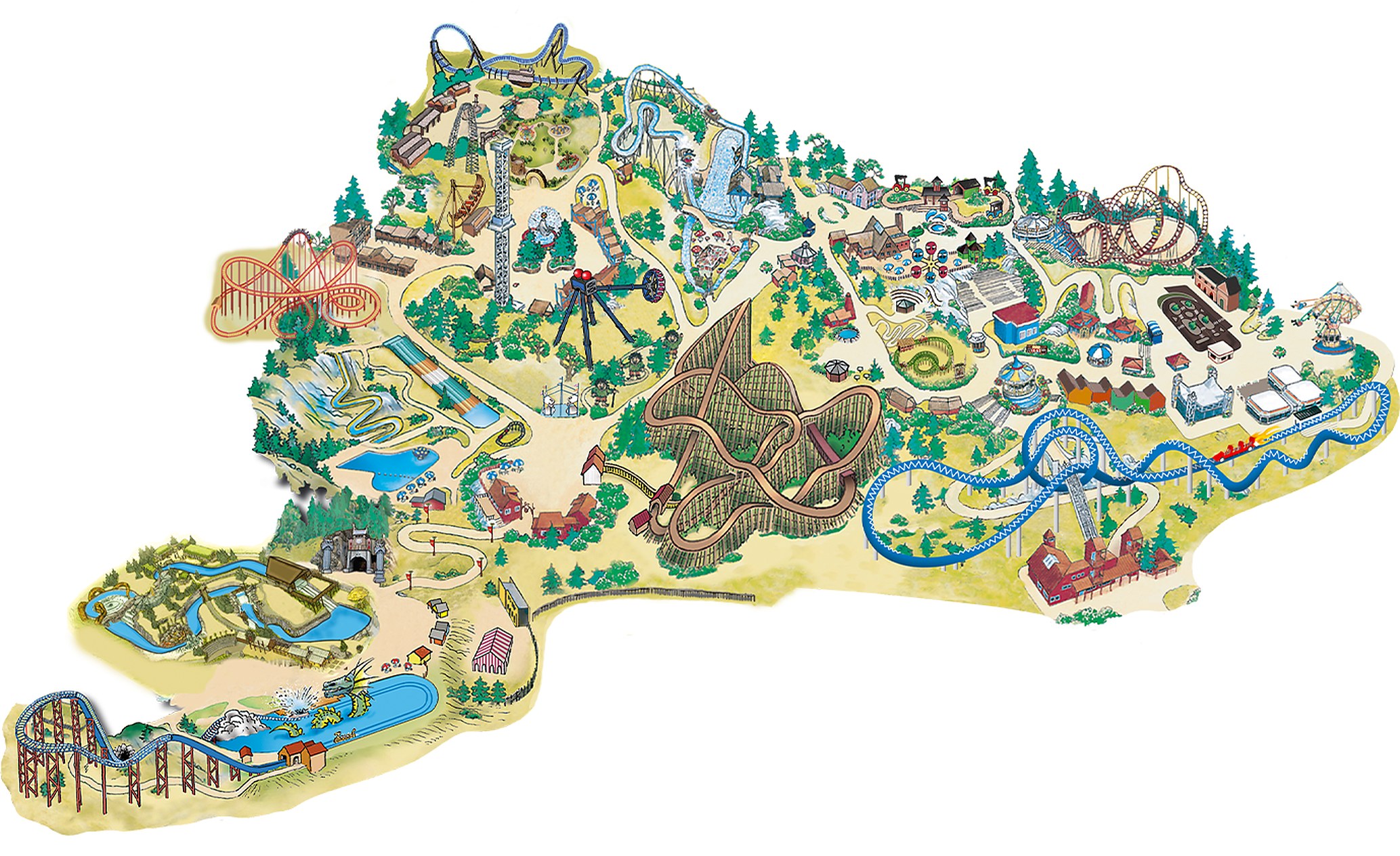
The park is at Vinterbro, south of Oslo. Its current website names Route 66, Expedition Lost Kingdoms, Dragonville and BadeFryd; use the interactive map for their attractions and services.
Archived park map layout reference. Use the current official map and operator website for attraction changes, closures, accessible routes and seasonal operations.
What to check for your 2026 visit
Plan around the current operating calendar and closure list. The named areas include both family attractions and intense rides, and individual attractions may have different hours.
Check the seasonal closure list. At the September 2026 review, the operator lists BadeFryd, Firestation Garage and Store Radiobiler as closed for the season, and Thors Hammer as closed. Short interruptions may not appear on that list.
Separate ordinary days from Halloween events. The 2026 Halloween program runs daily from September 26 to October 4, then on weekends through October 25. Check the event ticket and operating calendar before choosing a visit date.
Use the current area names. SpeedMonster and Loopen are in Route 66; ThunderCoaster and SpinSpider are in Expedition Lost Kingdoms. Storm and The Dungeon belong to Dragonville.
TusenFryd area navigator
TusenFryd spreads across a hilly site with named themed areas. These cards pair two exact 2022 landmark photos with dedicated saved coaster details. Use the current interactive markers and signs to connect your stops rather than assuming the illustrated paths form a short, flat loop.
SpinSpider and Expedition Lost Kingdoms
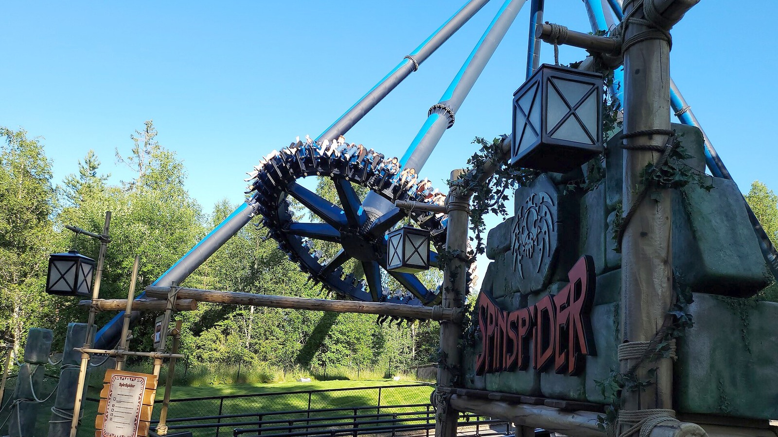
The photograph shows SpinSpider and its entrance sign in June 2022. Find it in Expedition Lost Kingdoms, which also includes ThunderCoaster, HuriHuri and Ekom Nkam–Tømmerstupet. Choose rides according to your group’s restrictions and preferences.
See on park map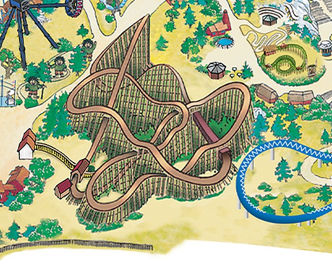
ThunderCoaster
This saved detail identifies ThunderCoaster’s wooden track. The operator places it in Expedition Lost Kingdoms and currently lists a 120 cm minimum height. Use the live attraction marker for the station and current access conditions.
See on park map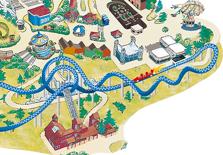
SpeedMonster
This saved detail shows SpeedMonster’s blue track and station. It belongs to Route 66, and the operator lists a 140 cm minimum height and a 90 km/h launch. Read its entrance signs and current operation before joining the queue.
See on park map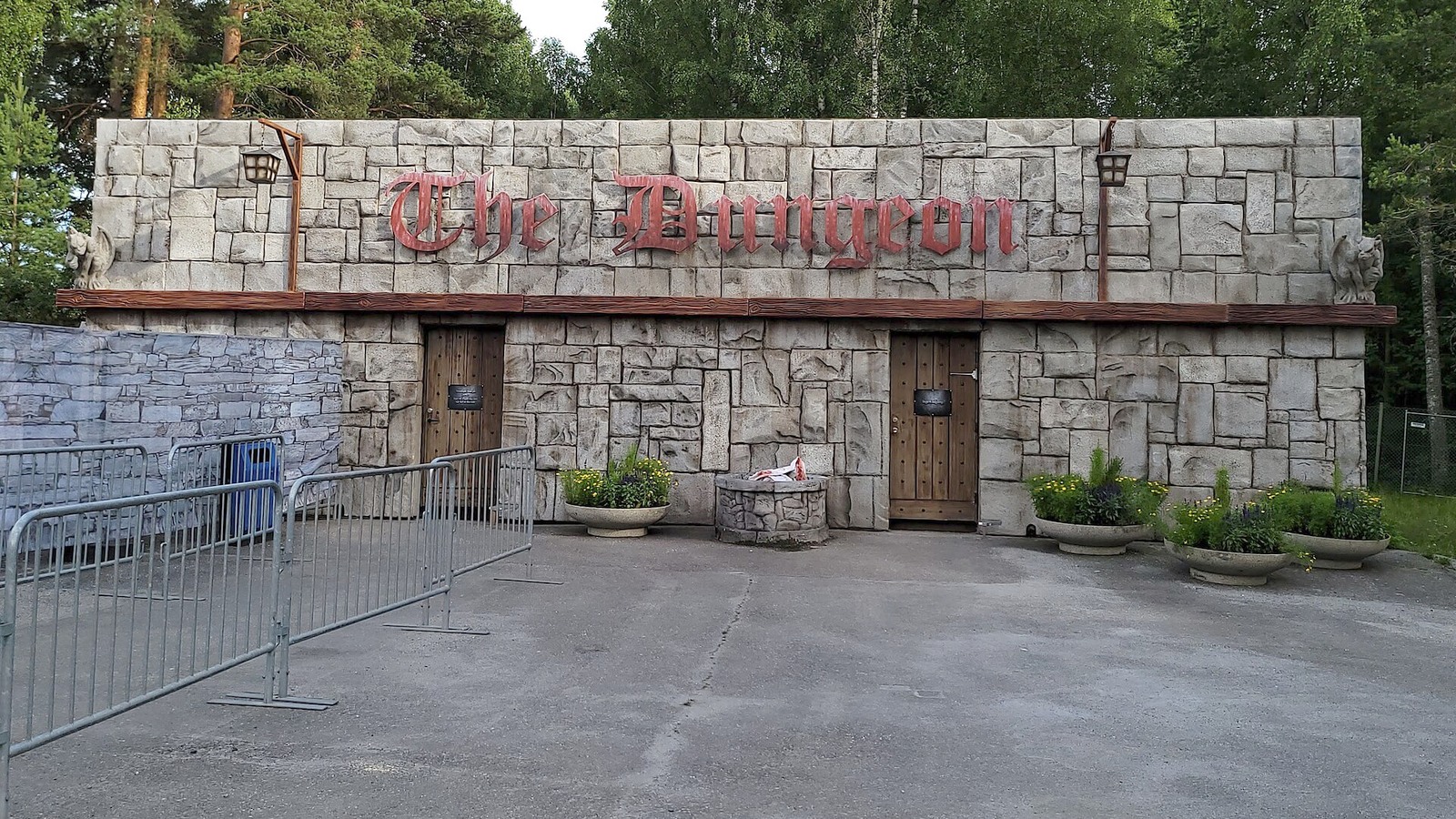
Dragonville and The Dungeon
The photograph shows The Dungeon facade in July 2022, now a landmark in Dragonville alongside Storm. This horror maze is intended for older visitors, carries an extra charge and is not wheelchair accessible. Check the operator’s age, companion and operating conditions.
See on park mapRead the official area names and attraction markers together. Route 66 combines rides such as SpeedMonster and Loopen with family attractions; Expedition Lost Kingdoms mixes HuriHuri with larger rides. Dragonville includes Storm and The Dungeon. BadeFryd is seasonal and is closed at this September review.
TusenFryd parking and directions
Use Fryds vei 25, 1407 Vinterbro, about 20 km south of Oslo. Follow the E6/E18 exit signs for TusenFryd, or check the operator’s current bus and rail connections before travelling.
TusenFryd and its Vinterbro arrival area. Use the current operator directions for the main entrance. View larger map.
Where to find guest services
The services most visitors hunt for on a map, and where each one sits inside TusenFryd, per the official legend.
Choose a route for your group
Choose a few suitable attractions, group them by themed area and allow time for the slopes. Adjust your route to the operation and queues you find on the day.
SpeedMonster first
For Route 66, locate SpeedMonster and Loopen on the current map, then check the height restrictions and operating status. Add suitable family stops without assuming every attraction in the area is open.
ThunderCoaster next
For Expedition Lost Kingdoms, group ThunderCoaster and SpinSpider with HuriHuri or a food break if those stops suit your group. These rides differ substantially in intensity and height requirements.
Save the family rides for later
For Dragonville, distinguish Storm from The Dungeon. The Dungeon is a paid horror maze with age and companion guidance, not a gentle dragon-boat ride for young children.
How to use this map
Start with your entrance route and the named areas. ThunderCoaster and SpinSpider belong to Expedition Lost Kingdoms, SpeedMonster is in Route 66, and Storm and The Dungeon are in Dragonville. The saved illustration helps identify structures, but use current interactive markers for entrances and the paved paths between slopes.
Save a screenshot of the current interactive map before travelling and keep the park’s closure list available. The linked operator map uses a base image with interactive attraction and service markers; no current downloadable PDF has been verified.
TusenFryd map: frequently asked questions
Where do I get the official TusenFryd park map?
Open the current operator interactive map using the link above. This page keeps a saved base layout and dated landmark photos for orientation; check the interactive markers and daily information before visiting.
Which areas contain TusenFryd’s major coasters?
SpeedMonster is in Route 66, ThunderCoaster is in Expedition Lost Kingdoms, and Storm is in Dragonville. Their separate attraction pages give current restrictions and operating information.
Where is TusenFryd?
The operator’s address is Fryds vei 25, 1407 Vinterbro, about 20 km south of Oslo. Follow current E6/E18 signs or verify the listed Oslo and Ski bus connections before travelling.
When is TusenFryd open?
Use the live calendar for your exact date. Halloween has its own program and some attractions close earlier or for the season; the current closure page should be checked alongside general park hours.
Can I save the TusenFryd map for offline use?
Save a screenshot of the current operator interactive map or the layout shown here. No current official downloadable PDF has been verified. Check the website again for later changes and service information before your visit.
Official maps and park information
Check the current official map and operator website for daily closures, seasonal operations and accessible routes. The area photos show landmarks that help you plan your route.