
Six Flags Hurricane Harbor Concord Park Map 2026
Where the Tornado, Breaker Beach, and the Kaanapali Kooler lazy river sit inside the Concord water park in the Bay Area.

Six Flags Hurricane Harbor Concord is a water park in Concord, California, in the San Francisco Bay Area.
The current Hurricane Harbor Concord map. Official map courtesy of Six Flags. Use the printable PDF for the day of your visit, or open the official map.
What is new on the 2026 map
Six Flags Hurricane Harbor Concord spreads slides, a wave pool, and a lazy river across the Bay Area water park, from the Tornado to Breaker Beach.
The Tornado is the big funnel. The Tornado and Break Point Plunge drop rafts and riders through their steep finishes.
Breaker Beach makes the waves. The Breaker Beach wave pool anchors the park with a big wave beach.
A Hawaiian theme throughout. The park themes its slides and pools around a Hawaiian island setting.
Six Flags Hurricane Harbor Concord area navigator
Six Flags Hurricane Harbor Concord is built as slide and pool zones, from the Tornado to the kids slides, the wave pool, and the lazy river. Each card shows that part of the official map.
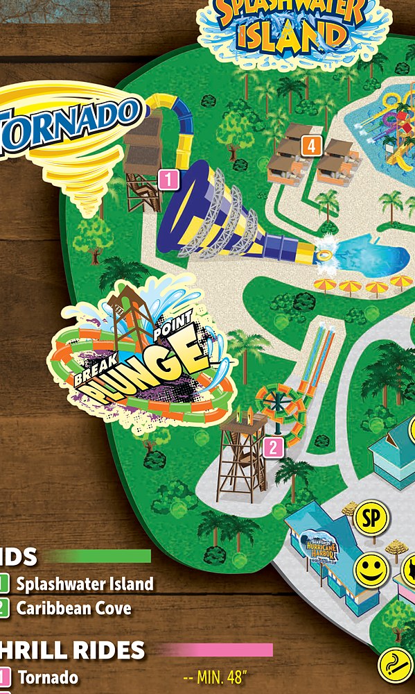
The funnel zone. The Tornado funnel and the Break Point Plunge drop slides gather at this end of the park.
See on park map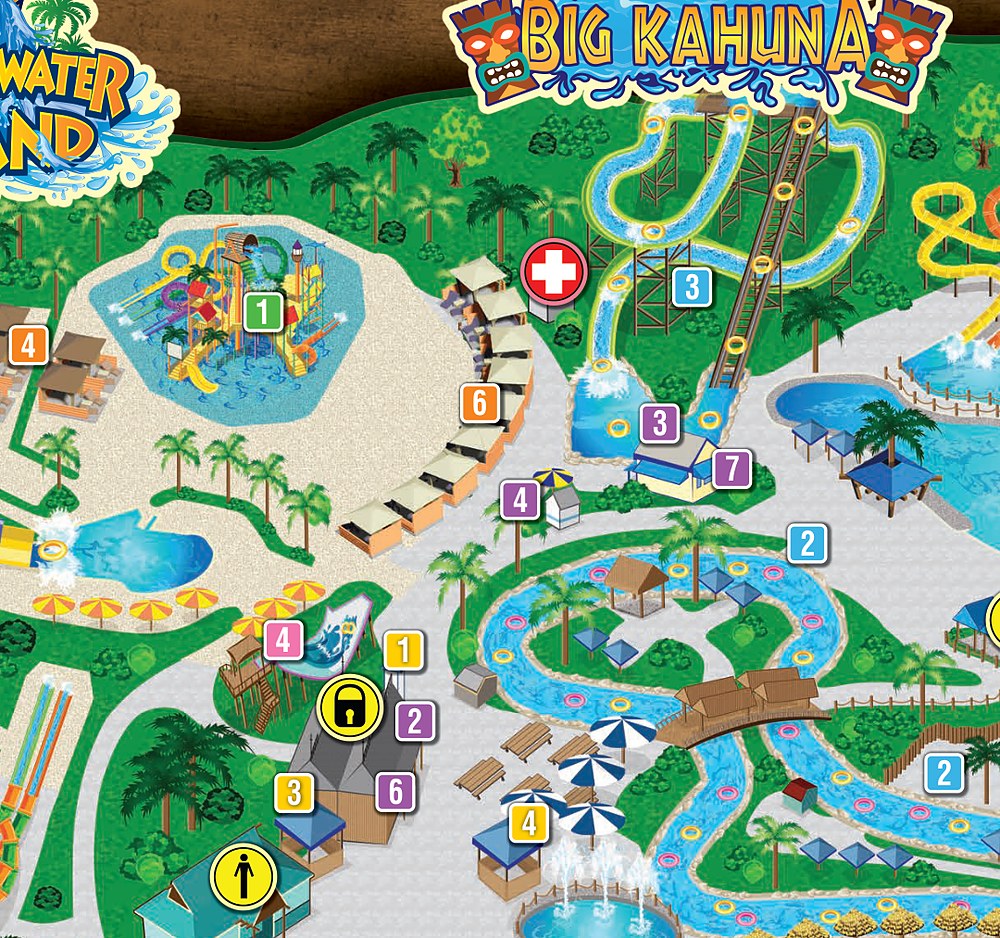
The family side. The Splashwater Island kids zone and the Big Kahuna slides gather the gentler attractions.
See on park map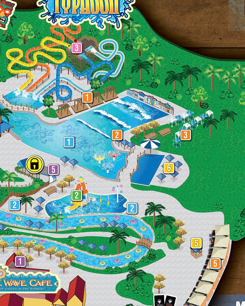
The wave zone. The Typhoon slides and the Breaker Beach wave pool gather on this side.
See on park map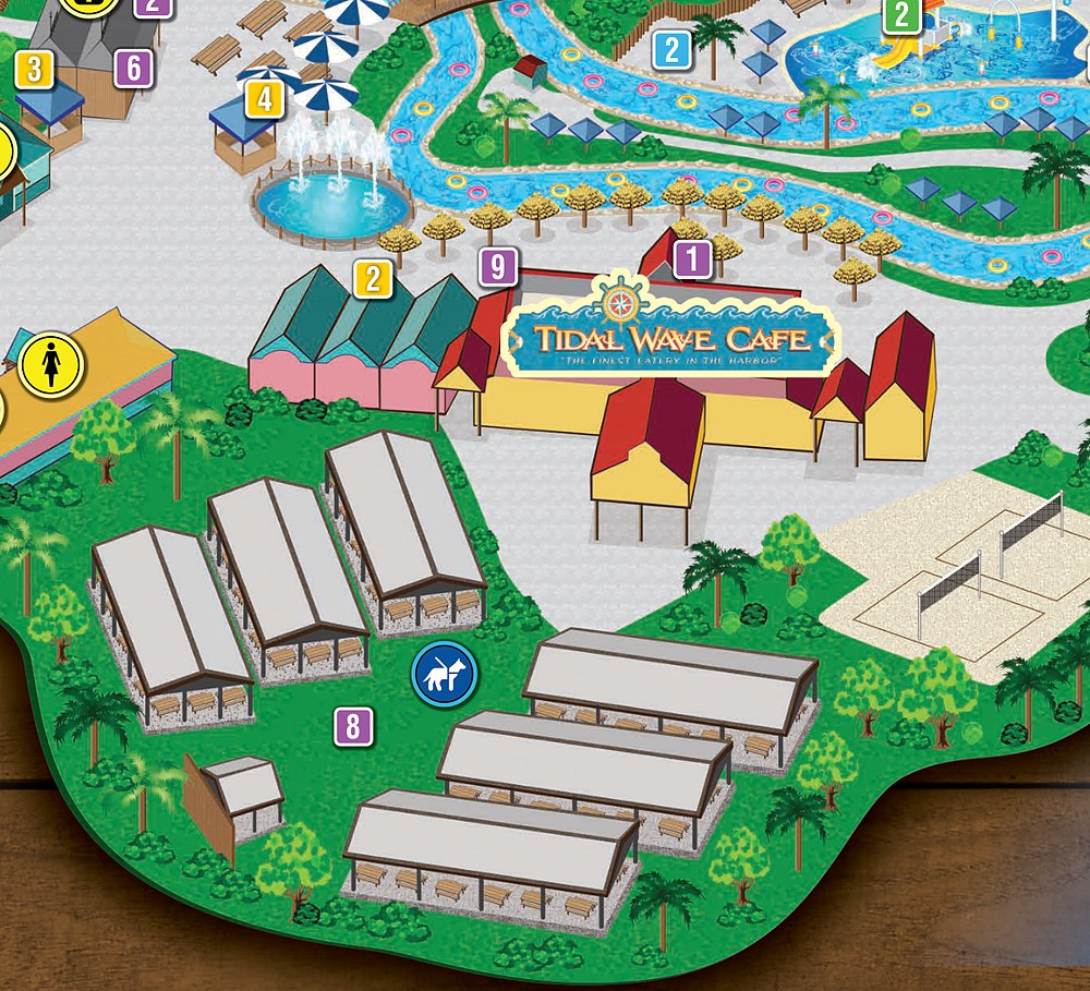
The river side. The Kaanapali Kooler lazy river winds past the Tidal Wave Cafe around the park.
See on park mapThe official map marks the slides and pools by name, including the Tornado, the Breaker Beach wave pool, the Big Kahuna slides, and the Kaanapali Kooler lazy river, across the water park.
Six Flags Hurricane Harbor Concord parking and directions
The park sits in Concord in Contra Costa County, California, in the San Francisco Bay Area. It is reached by car from Highway 242 to the Willow Pass Road exit, with parking at the gate.
Hurricane Harbor Concord sits in Concord in the San Francisco Bay Area, reached by car from Highway 242 to Willow Pass Road. View larger map.
Where to find guest services
The services most visitors hunt for on a map, and where each one sits inside Hurricane Harbor Concord, per the official legend.
At opening, where to start
Hurricane Harbor Concord draws big crowds on hot days, so ride the Tornado and the big slides early before the queues and the midday sun build.
The Tornado first
Head to the Tornado and Break Point Plunge at opening, since they draw the longest lines of the day.
The Typhoon slides next
Ride the Typhoon slides and the Big Kahuna early, before the far side of the park fills up.
Wave pool and river midday
Settle into the Breaker Beach wave pool and the Kaanapali Kooler lazy river in the middle of the day, when the big-slide queues peak.
How to use this map
Orient by the Breaker Beach wave pool. The Tornado and Break Point Plunge sit at one end, the Splashwater Island kids zone and Big Kahuna slides gather on another, the Typhoon slides and wave pool fill one side, and the Kaanapali Kooler lazy river winds around the park. The tall slide towers are the easiest landmarks.
For a copy you can carry without signal, open the printable PDF map linked at the top of this page and save it to your phone, or print it at home. For live details, check the official Hurricane Harbor site. The area navigator above is the fastest way to see which part sits where.
Six Flags Hurricane Harbor Concord map: frequently asked questions
Where do I get the official Hurricane Harbor Concord map?
The official map is on this page, with the printable PDF one tap away. Six Flags also posts it on the official site.
What are the biggest slides at Hurricane Harbor Concord?
The headline attractions include the Tornado funnel, the Break Point Plunge drop slides, and the Breaker Beach wave pool.
Is Hurricane Harbor Concord good for young children?
Yes. Splashwater Island gathers a kids zone and gentle slides, alongside the bigger slides for older visitors.
How do you get to Hurricane Harbor Concord?
The park sits in Concord in the San Francisco Bay Area. Take Highway 242 to the Willow Pass Road exit, with parking at the gate.
Is there a printable Hurricane Harbor Concord map PDF?
Yes. Use the Printable PDF map button under the map above for the official sheet, sized for a clean print or offline save.