
Pacific Park Map: Santa Monica Pier Rides and Walking Routes
Pacific Park occupies a compact part of the Santa Monica Pier. Use the Pacific Wheel and West Coaster as your main landmarks, then choose the rides, games and food stops that fit your visit. Open the official map below for exact attraction positions; the photo navigator helps you recognize the park when you arrive.
Map sources checked September 19, 2026
The operator’s map page includes its current attraction directory and a download link. Keep that page handy for exact locations and check the operating calendar separately for closures.
Pacific Park layout at a glance
Think of this visit in two parts: reaching the pier, then finding the amusement park. A parking destination and a ride entrance are different points on your route. Choose your parking or transit approach first, and use the wheel and coaster to orient yourself once you are on the pier.
Pacific Park is ungated, so you can walk into the amusement area without buying a general admission ticket. Rides and games have their own payment arrangements. That makes a short landmark visit possible, but riders should settle their ticket or wristband choice before joining a queue.
- Reach the pierFollow the current walking approach from your parking location or Downtown Santa Monica.
- Find the wheel and coasterUse the two large ride structures to identify the amusement area.
- Group your smaller stopsCheck the map for family rides, the midway and a convenient break before heading back.
These are planning stops, not a scale map. Use the operator map and signs for exact paths, entrances and accessible routes.
Pacific Park photo area navigator
These three landmark groups are a way to organize a compact pier visit. They are not additional themed lands. Match the photographs to the signs around you, then use the official map for the final path to each ride entrance.
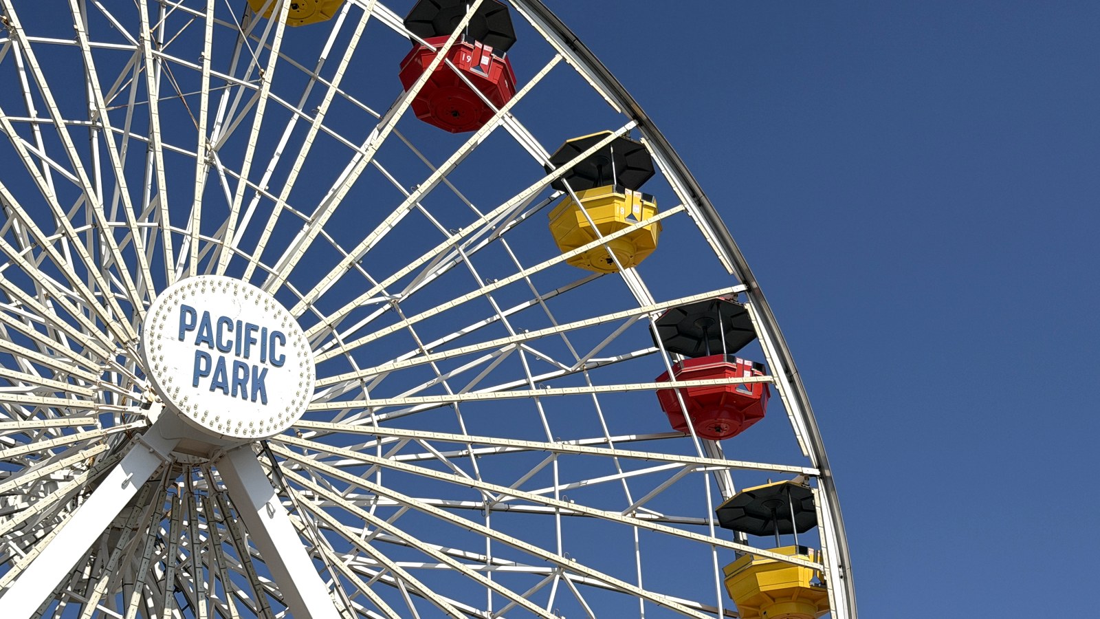
Pacific Wheel and its ticket area
The Pacific Wheel is the easiest large structure to spot as you approach the amusement park. Use it to establish where you are, then look for the actual queue entrance instead of walking toward the tallest visible part of the ride.
For a mixed group of riders and nonriders, agree on a signed meeting point outside the queue before splitting up. A photo of that exact spot is more useful than a general instruction to meet somewhere by the wheel.
Landmarks: Pacific Wheel; nearby ticket booth.
Route tip: Check the wheel’s current operation and your ticket option before committing the group to a queue.
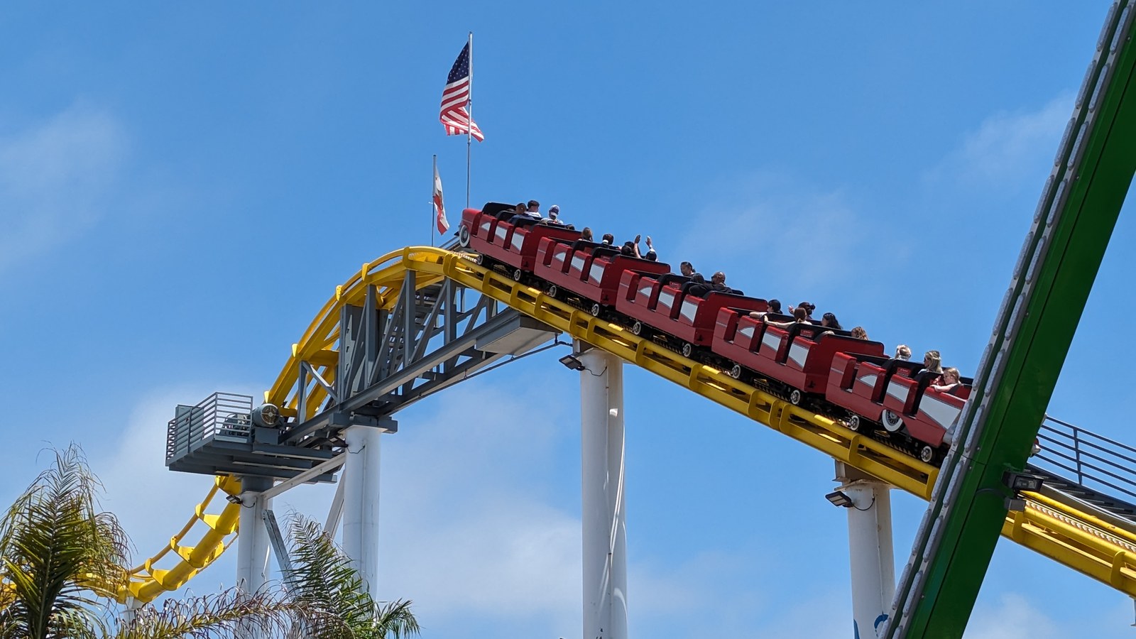
West Coaster and the larger rides
West Coaster is the park’s steel roller coaster. Its visible track is a good orientation cue, but the track itself is not a walking route. Locate the boarding entrance on the operator map before moving through the surrounding midway.
If the coaster is the reason for your visit, check it first. Then decide which other larger rides suit the group. The current ride directory lists the Pacific Plunge and Sea Dragon among the park’s thrill options; check the individual restrictions at each ride.
Landmarks: West Coaster, Pacific Plunge and Sea Dragon on the operator’s ride list.
Route tip: Choose the priority ride first, then use the map to group nearby stops rather than crossing the midway repeatedly.
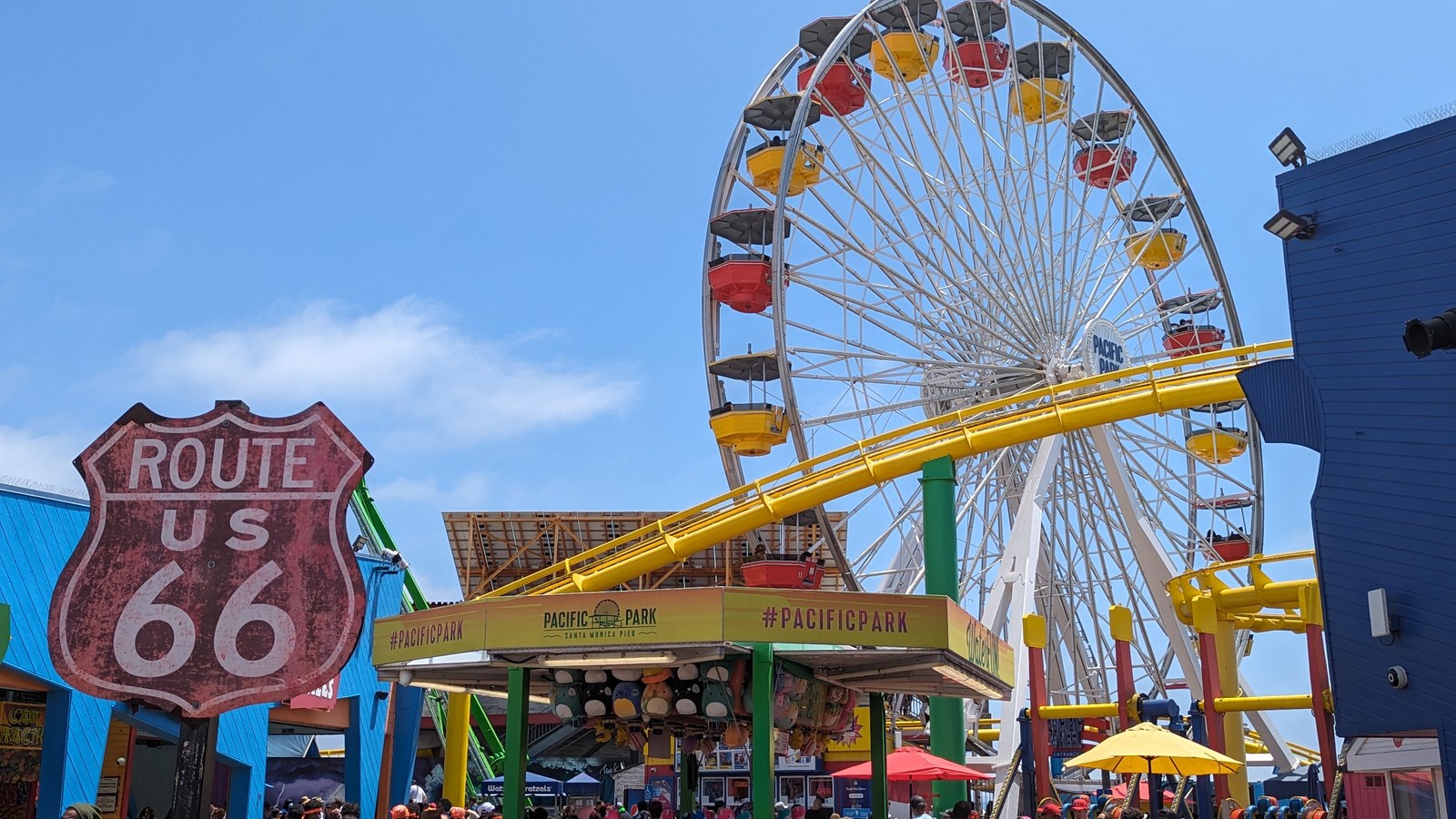
The park entrance and a family midway circuit
The Route 66 sign in the photograph helps identify the amusement park entrance, with the wheel and coaster beyond. Pause here to agree on the first stop and a meeting point before the group disperses into rides, games and food stops.
The official map separately labels Kid’s Cove, family rides, midway games and food areas. Use those labels to select a short circuit that suits younger riders. Check individual restrictions and current operation before buying: an attraction symbol establishes its location, not that it is running right now.
Landmarks: Route 66 entrance sign; family-ride, midway and food labels on the operator map.
Route tip: Choose a meeting point at entry, then plan suitable family rides and a break on one short circuit.
Park day gear worth packing
A compact set of comfort picks for long lines, heat, rain, refills, and high step counts.


Choose a route that fits your visit
Pacific Park does not need the same touring plan as a large destination park. The useful decision is how much riding you want to do and where the group will rejoin. These are suggested planning sequences, not forecasts of waits.
| Your priority | A useful starting plan | Check before moving on |
|---|---|---|
| A brief pier visit | Find the wheel, walk through the amusement area and choose one optional ride. | The return walk and any parking time limit. |
| Coaster first | Check West Coaster, then compare the other larger rides with your group’s preferences. | Current operation and each rider’s eligibility. |
| Younger children | Use the family ride and Kid’s Cove labels to choose a small set of suitable stops. | Companion rules, ride restrictions and a nearby break. |
| Mixed riders and nonriders | Choose a specific meeting point, then plan a short riding circuit. | Whether everyone has the ticket or wristband they need. |
- Choose the arrival route and save the location of your parking space or transit stop.
- Open the operator map on your phone and identify the wheel, coaster and any family rides that matter to you.
- Confirm today’s operation and the relevant ride restrictions before buying for the group.
- Agree on a meeting point outside a queue, especially if only some visitors will ride.
- Leave time to walk off the pier and return to the correct parking or pickup location.
Arrival, services and accessible routes
Parking is an arrival decision
The park directs drivers toward beach-level parking and warns that traffic patterns and parking access can change during pier work. Its directions list 1550 Appian Way for the beach lot. Recheck the current parking notice before driving, and use the posted lot rates rather than an old map or price screenshot.
Walking from Downtown Santa Monica
The operator describes a walking approach west along Colorado Avenue, across Ocean Avenue and onto the pier. If arriving by transit, confirm the service and station route with the transit operator on your travel date. Save the return direction before entering the busy pier area.
Mobility and family equipment
Ask the park about the suitable approach and ride-specific access before relying on stairs or a particular boarding route. Pacific Park’s FAQ says it does not provide wheelchair or stroller rentals. Bring necessary equipment and check the current visitor guidance before arrival.
Help and changing operations
For assistance on site, ask a uniformed park employee. Keep the operating calendar and visitor FAQ available alongside the map. A ride’s location may remain the same even when weather, maintenance or limited operations change what is available.
How to use the map on the day
Open the map before your visit while you have a reliable connection. If the operator’s download works on your device, save it for reference and check it against the live map page again near your visit. A saved version can show where a ride sits; it cannot confirm today’s hours or closures.
On the pier, match a large landmark first, then look for the smaller signed entrance you need. For a return trip, reverse the walking plan to your chosen parking or transit point rather than following the nearest staircase without checking where it leads.
Pacific Park map questions
Where is the official Pacific Park map?
Pacific Park publishes its map and attraction directory at pacpark.com/map/. That page also provides the operator’s download link.
Is Pacific Park the whole Santa Monica Pier?
No. The operator describes Pacific Park as occupying two acres of the seven-acre pier. Use the park map for amusement attractions and the arrival guidance for the wider pier approach.
Do I need a ticket just to walk through Pacific Park?
The park is ungated and does not charge a general entrance fee. Riding and playing games have separate payment arrangements; check current options before joining a queue.
Which landmarks are easiest to recognize?
The Pacific Wheel and West Coaster are useful large visual landmarks. Use them to orient yourself, then follow the operator map and signs to the actual ride entrances.
Can I assume every ride shown on the map is open?
No. Check the operating calendar and the park’s current visitor information. Weather, maintenance and limited operations can affect availability.
Does Pacific Park rent wheelchairs or strollers?
The operator’s FAQ says wheelchair and stroller rentals are not available. Plan necessary equipment and confirm access needs with the park before visiting.
Official sources
- Pacific Park official mapCurrent map access, park boundary and attraction directory.
- Pacific Park ridesOfficial ride names and attraction-specific visitor requirements.
- Pacific Park visitor questionsEntry arrangements, visitor equipment and operational caveats.
- Pacific Park directionsPier approach, driving destination and walking orientation.
- Pacific Park parking guidanceParking choices and current traffic-change notices.
- Santa Monica Travel and Tourism pier guideWider pier orientation and current bridge-work arrival notices.