
Kongeparken Map 2026
Use the current 2026 map for Borggarden, Flo og fjare, Gratassland, Eventyrskogen, parking, and guest services.
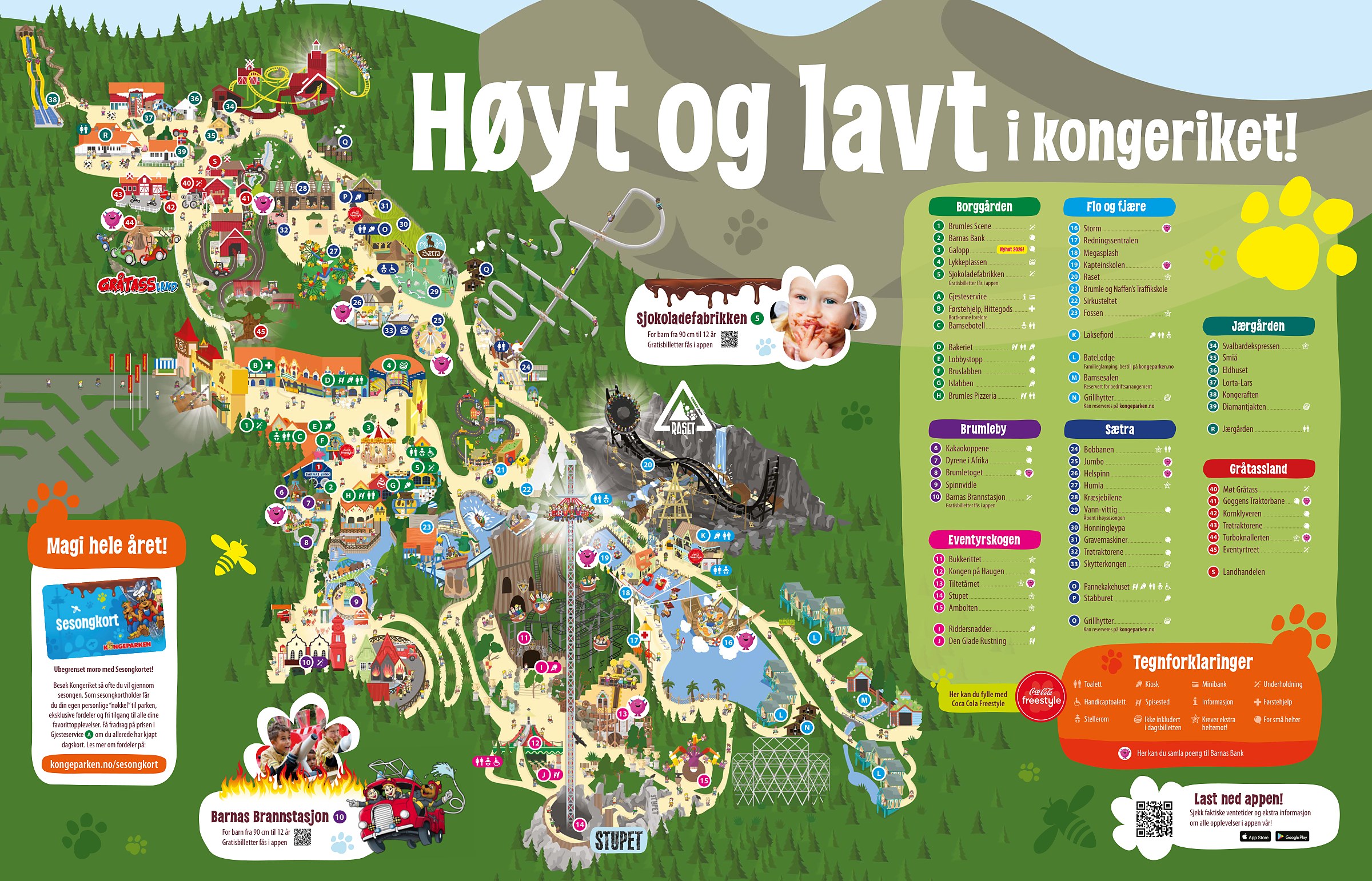
The official sheet covers the full amusement park in one view.
Archived park map layout reference. Use the current official map and operator website for attraction changes, closures, accessible routes and seasonal operations.
Map highlights and current planning notes
The current operator 2026 sheet numbers 45 attractions and shows food, information, First Aid, accessible toilets, baby care, and other service symbols. The app adds live waits and operating updates.
The map has seven named areas. Borggarden, Brumleby, Eventyrskogen, Flo og fjare, Saetra, Jaergarden, and Gratassland each have a separate colored legend. The four navigator cards below highlight entrance services and three useful ride clusters.
Galopp is marked new for 2026. Find it at number 3 in Borggarden. For the water and thrill cluster, the same sheet places Storm at 16, Raset at 20, and Fossen at 23 in Flo og fjare.
Use the app for operating updates. The printable sheet gives attraction numbers and service symbols; the operator app adds park navigation, wait times, operating messages, and show reservations.
Kongeparken area navigator
Use Borggarden for arrival services, Flo og fjare for Storm, Raset, and Fossen, Gratassland for its family attractions, and Eventyrskogen for Stupet and nearby rides. These four cards are a starting point; the full map also covers Brumleby, Saetra, and Jaergarden.
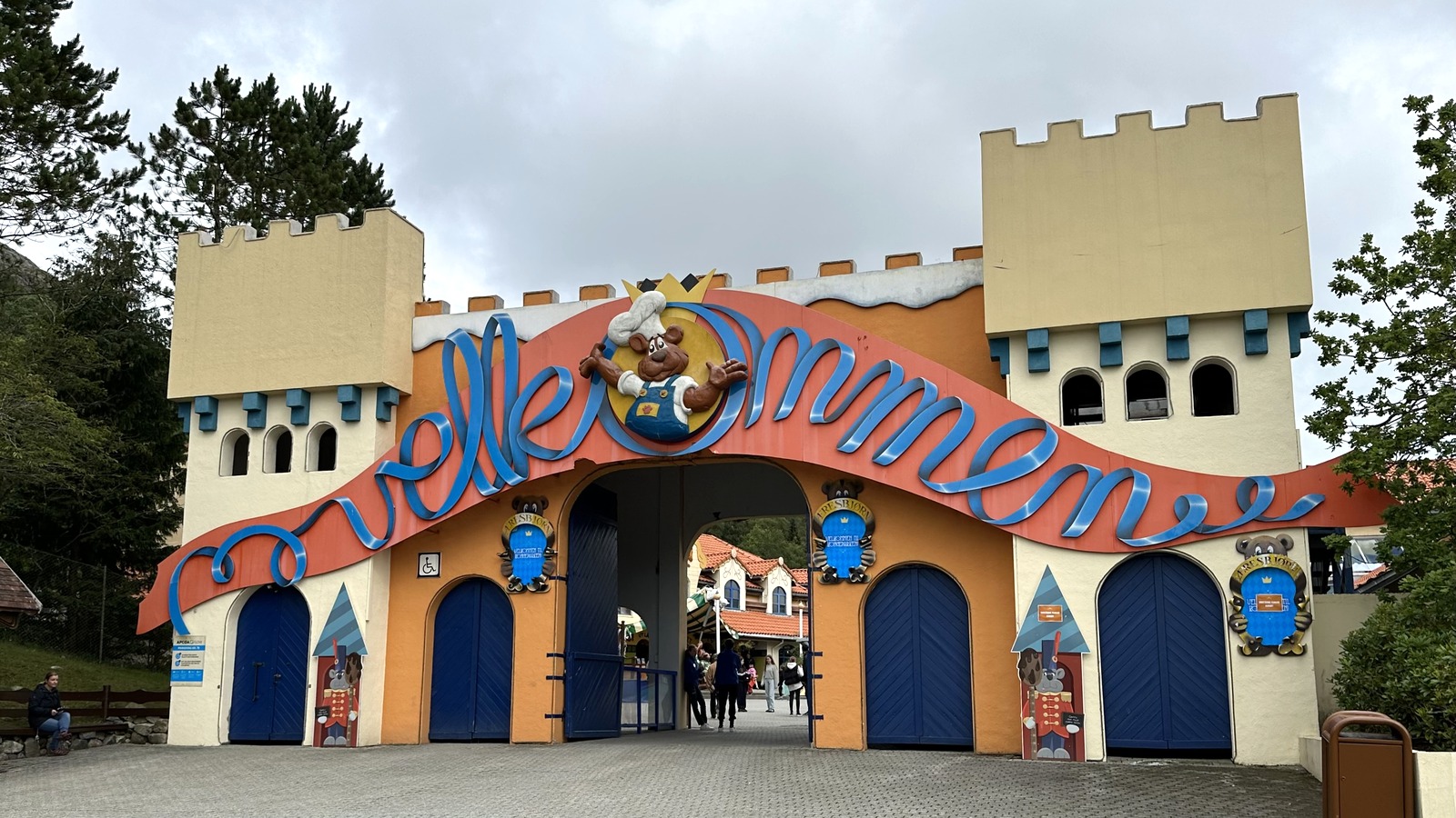
Borggarden
Enter beside Gjesteservice A. First Aid and lost property are at B, baby care is at C, and Galopp 3 is inside Borggarden. Resolve arrival and accessibility questions before continuing to the rides.
See on park map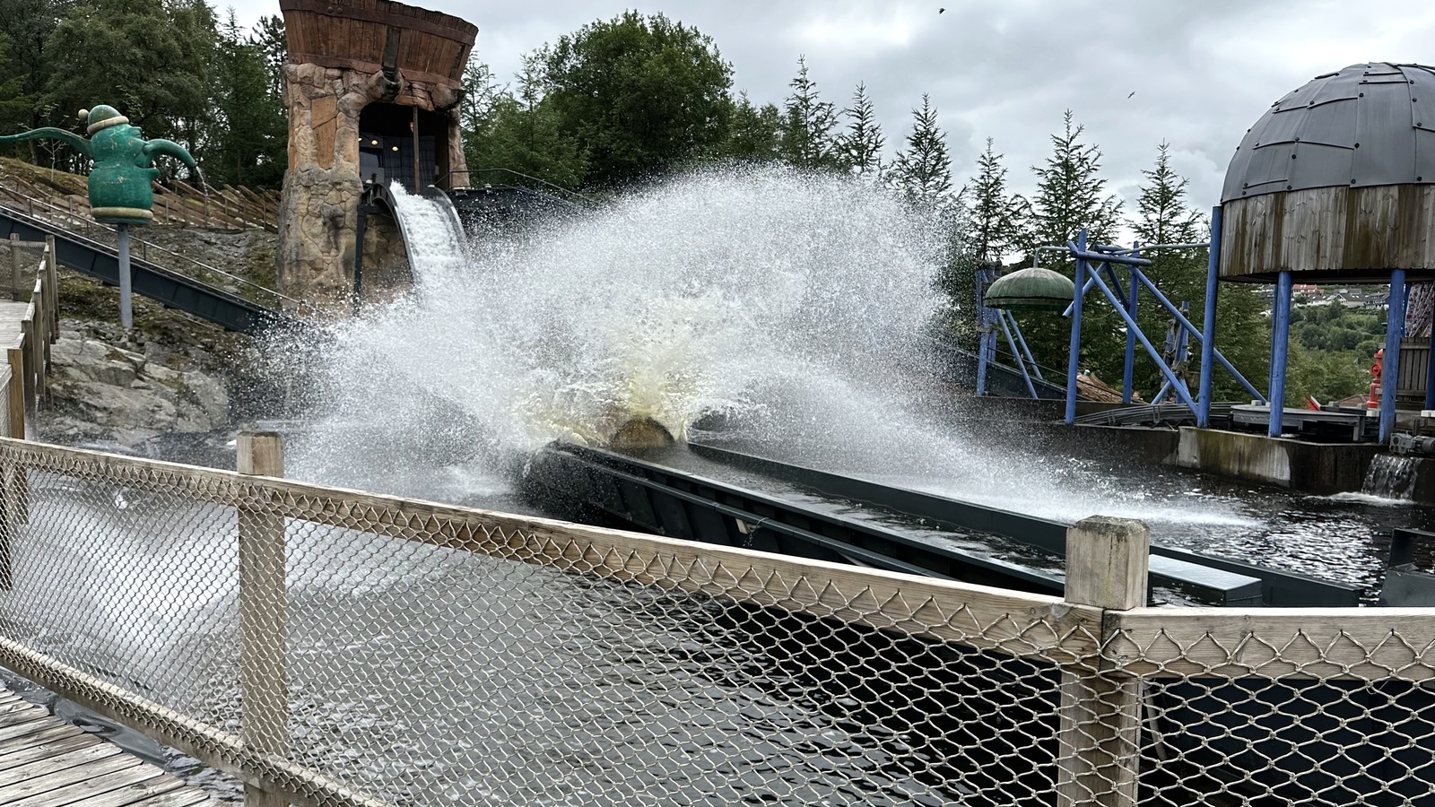
Flo og fjare
The current map places Storm at 16, Megasplash at 18, Raset at 20, and Fossen at 23. Laksefjord K is a nearby food stop. Check the app before walking to your next attraction.
See on park map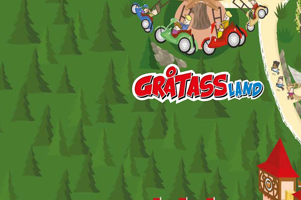
Gratassland
Use the Gratassland label to find Meet Gratass 40, Goggens Traktorbane 41, Kornklyveren 42, Trotraktorene 43, Turboknallerten 44, and Eventyrtreet 45. Open the full map for the numbered legend.
See on park map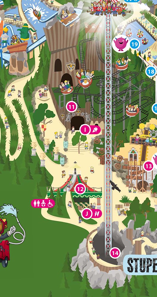
Eventyrskogen
The current sheet groups Bukkerittet 11, Kongen pa Haugen 12, Tiltetarnet 13, Stupet 14, and Ambolten 15 in Eventyrskogen. The saved detail shows Stupet and nearby rides; use the full map for all five markers.
See on park mapRead the colored legend as seven groups: Borggarden 1 to 5, Brumleby 6 to 10, Eventyrskogen 11 to 15, Flo og fjare 16 to 23, Saetra 24 to 33, Jaergarden 34 to 39, and Gratassland 40 to 45. Letters identify food and guest services; icons distinguish toilets, accessible toilets, baby care, First Aid, and activities needing extra tickets.
Kongeparken parking and directions
The park sits in Algard, a short drive south of Stavanger in Rogaland county. The main lot feeds the front gate at Borggarden.
Kongeparken at Kongsgata 20 in Algard. Use the locator for the park entrance, approach roads, and adjacent visitor parking. View larger map.
Where to find guest services
The services most visitors hunt for on a map, and where each one sits inside Kongeparken, per the official legend.
At opening, where to start
Choose a route around your priority attractions and rider requirements. Check the app for current waits and operating messages, then group nearby stops to reduce repeated walks.
Flo og fjare for Storm
Find Storm at 16 in Flo og fjare. Group it with Megasplash 18, Raset 20, or Fossen 23 if those attractions suit your group and are operating.
Eventyrskogen for Stupet
Use Stupet 14 as the Eventyrskogen landmark, then check Bukkerittet 11, Kongen pa Haugen 12, Tiltetarnet 13, and Ambolten 15 on the same colored legend.
Gratassland for young kids
Use the Gratassland label for attractions 40 to 45. Check individual rider requirements first; family facilities and the baby-care room at Bamsebotellet C can help shape the day.
How to use this map
Start with Gjesteservice A at the entrance and identify the color for your first attraction. Match its number to the full legend, then plan nearby rides, food, and restrooms together. The four photo cards are route anchors; use the complete seven-area map to include Brumleby, Saetra, and Jaergarden.
For a copy you can carry without signal, open the printable PDF map linked at the top of this page and save it to your phone, or print it at home. For current opening hours, check the official site before your visit. The area navigator above is the fastest way to see which ride sits in which part of the park.
Kongeparken map: frequently asked questions
Where do I get the official Kongeparken map?
Open the current PDF map button above or the map link on the operator planning page. Save the PDF for offline use and use the operator app for live waits, navigation, and operating messages.
How many areas are on the Kongeparken map?
The current 2026 map has seven named areas: Borggarden, Brumleby, Eventyrskogen, Flo og fjare, Saetra, Jaergarden, and Gratassland. Its legend numbers attractions from 1 to 45.
Where is Storm on the Kongeparken map?
Storm is attraction 16 in Flo og fjare. The same area includes Megasplash 18, Raset 20, and Fossen 23; check the app for current operation before heading over.
Where are First Aid and baby-care facilities?
First Aid and lost property are marked B by the entrance. Bamsebotellet C has a larger baby-care room; the operator also lists changing tables in toilets across the park.
Is there a printable Kongeparken map PDF?
Yes. The current PDF map button above opens the operator-linked 2026 sheet. Save it before arriving for an offline layout reference; live operating information remains in the app.
Official maps and park information
Check the current official map and operator website for daily closures, seasonal operations and accessible routes. The area photos show landmarks that help you plan your route.