
Park Map Vinhedo, São Paulo, Brazil
Hopi Hari Map 2026
Open the operator map, find nearby attractions and plan your arrival with the area guide below.

- Source
- Map courtesy of Hopi Hari
- Edition
- Operator Portuguese Karta PDF; printed edition unconfirmed. Preview matches the unchanged hosted file.
- Checked
Area by Area
Hopi Hari Map Guide
Use these planning areas to group nearby stops. Check current operator information and signs for attraction availability.
Kaminda Mundi begins near the entrance. The map separates Mistieri, Infantasia, Wild West and Aribabiba; choose neighboring attractions before crossing to another region.
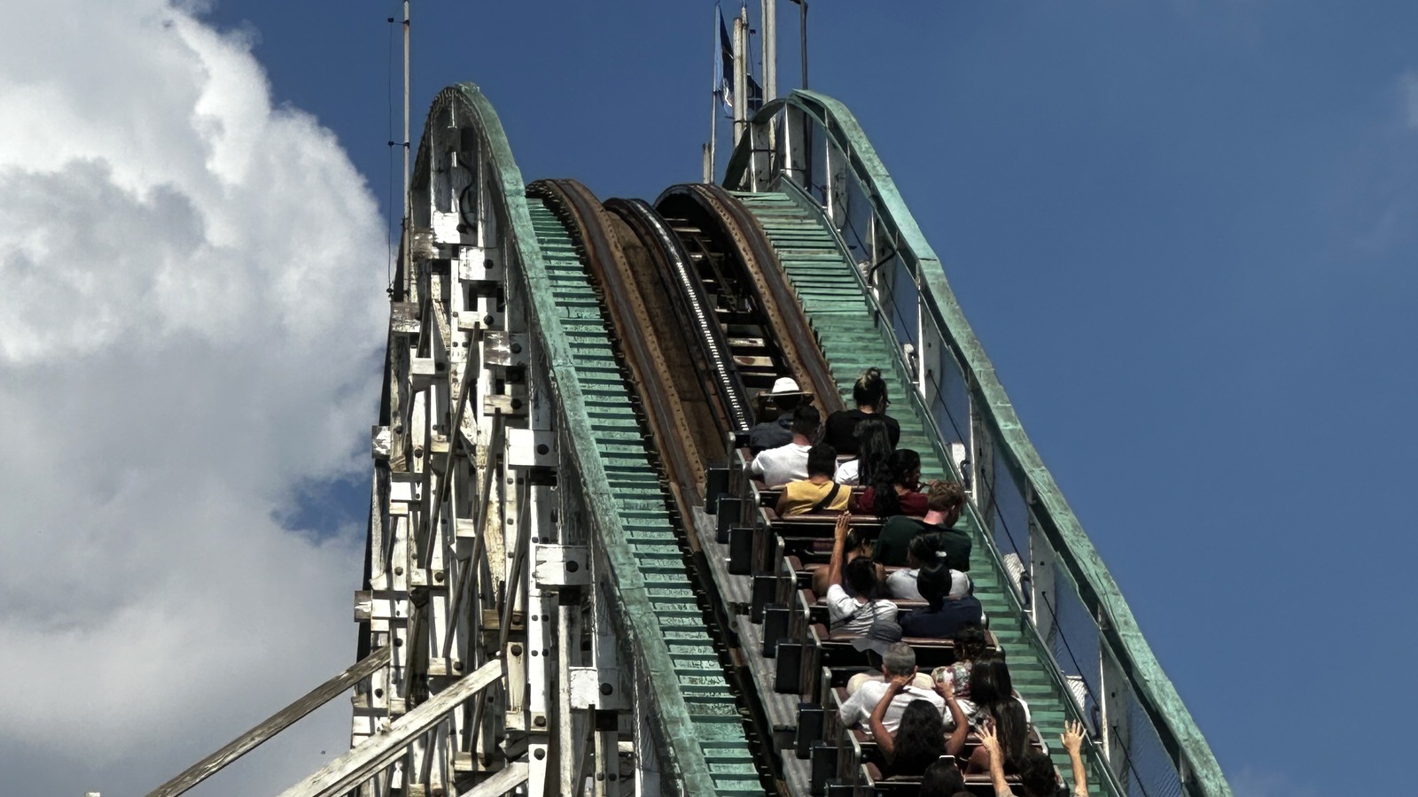
Mistieri
Area
HeadlinersLandmark: Montezum
The photograph shows Montezum’s lift hill in Mistieri.
Photo: Hopi Hari, Vinhedo, Brazil by Martin Lewison , CC BY 2.0. Cropped.

Infantasia
Area
HeadlinersLandmark: Kastel di Lendas
The photograph shows Kastel di Lendas.
Photo: Hopi Hari. Cropped.

Toka do Uga
Area
HeadlinersLandmark: the cave entrance
The photograph shows the Toka do Uga entrance in Infantasia.
Photo: Hopi Hari. Cropped.
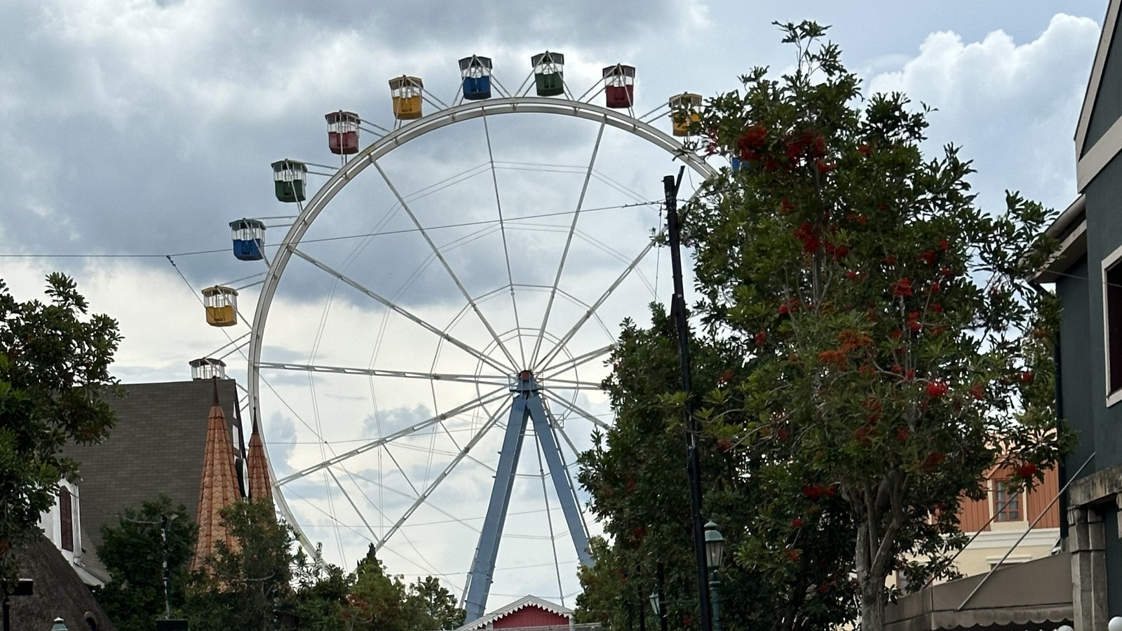
Kaminda Mundi
Area
HeadlinersLandmark: Giranda Mundi
The photograph shows Giranda Mundi above Kaminda Mundi.
Photo: Hopi Hari by Martin Lewison , CC BY 2.0. Cropped.
More Areas on the Map
- Aribabiba and Wild WestThe full Karta has five named regions. Locate Aribabiba and Wild West on the sheet rather than treating every family attraction as part of the same area.
Related Park Maps
Parking and Arrival
Hopi Hari Parking Map
The overview locates the park and arrival vicinity. Use operator directions and signs for the correct entrance.
- Getting Here
- Hopi Hari is beside Rodovia dos Bandeirantes at km 72 in Vinhedo, São Paulo state. Follow the current operator arrival guidance for the road approach.
- Parking and Entry
- Check the current operator parking information, admission inclusions and visit-day signs before arriving. The overview locates the park vicinity; it is not a parking-space availability feed.
- Route Planning
- Kaminda Mundi begins near the entrance. The map separates Mistieri, Infantasia, Wild West and Aribabiba; choose neighboring attractions before crossing to another region.
Quick Answers
Hopi Hari Map FAQ
Is there a printable Hopi Hari map PDF?
PDF Map opens the unchanged file hosted by Deep Arrival. Operator Portuguese Karta PDF; printed edition unconfirmed. Preview matches the unchanged hosted file.
How do I plan a route using this map?
Kaminda Mundi begins near the entrance. The map separates Mistieri, Infantasia, Wild West and Aribabiba; choose neighboring attractions before crossing to another region.
How do the five regions help with routing?
Kaminda Mundi, Mistieri, Infantasia, Aribabiba and Wild West organize the full Karta. Match each attraction’s marker to its region before choosing a path; the printed PDF is not a live queue feed.
Where do I arrive for Hopi Hari?
Hopi Hari is beside Rodovia dos Bandeirantes at km 72 in Vinhedo, São Paulo state. Follow the current operator arrival guidance for the road approach.
Does the map show live waits and closures?
No. A map shows locations, not visit-day operation. Check the official app, attraction pages and posted signs for availability. Park Tools links only to this destination’s existing planning pages.
Sources
Operator files checked . Map editions and seasonal limits are identified separately from the source check date.