
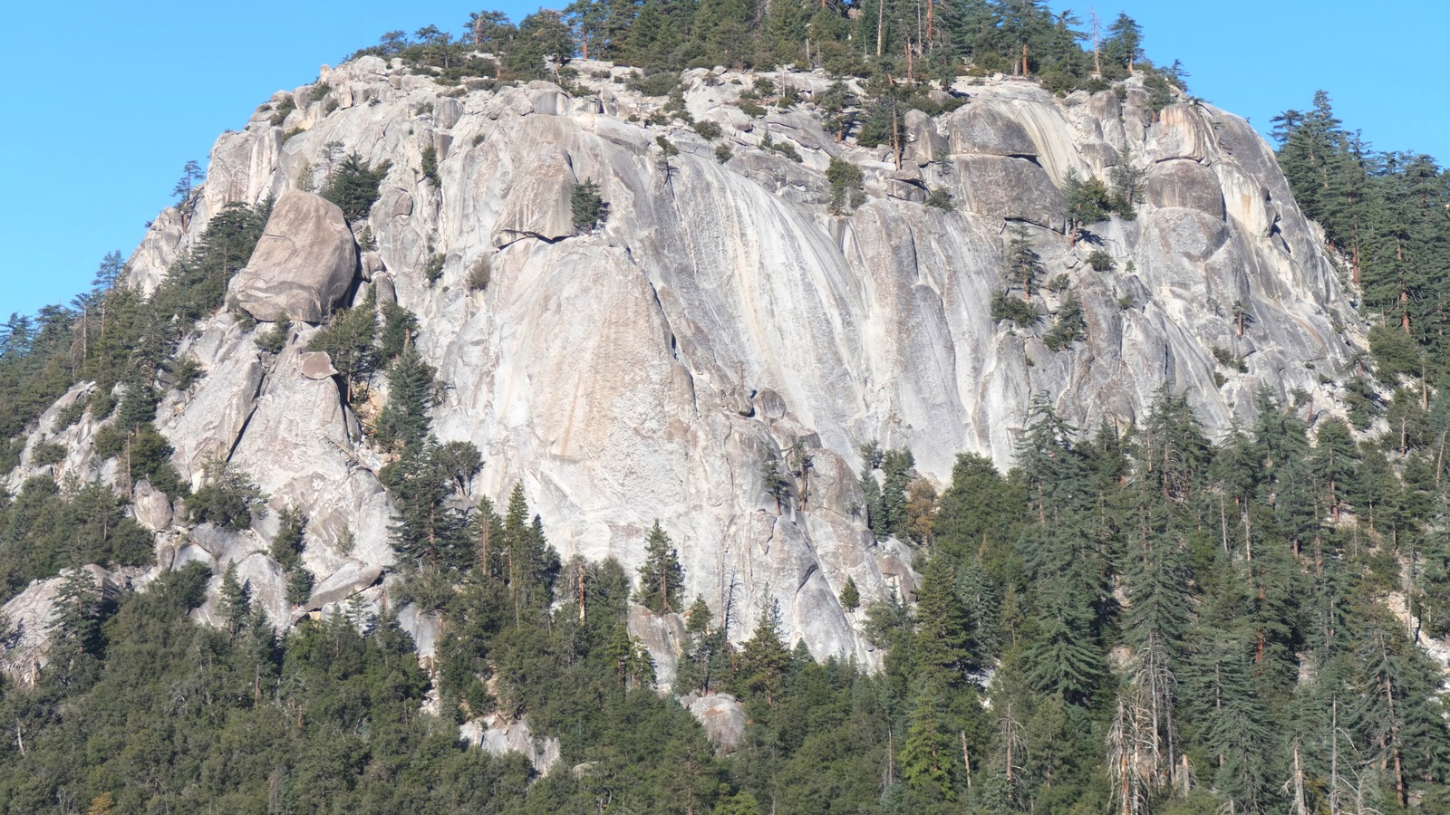
Idyllwild is a mile high pine village on the western side of the San Jacinto Mountains, close enough to Palm Springs to see the desert from the ridges above it and cold enough to hold snow into spring. Almost every reason to come here starts at a trailhead, and almost every trailhead needs either an Adventure Pass on the windshield, a free wilderness permit in the pocket, or both, which is the single thing most first time visitors get wrong.
The top 12, ranked
Ranked by how consistently each pick appears across official Idyllwild sources, the local destination marketing organization, and recent independent roundups.
- Top pick
1Best for Hiking · #1 of 12
Devils Slide Trail to Saddle Junction
ParkHumber Park and the wilderness trailheadsOpen through the year in daylight, with snow and ice on the upper switchbacks from late autumn into spring and traction devices often neededFreeThe classic Idyllwild hike climbs about 1,700 feet in two and a half miles of switchbacks from Humber Park to Saddle Junction, where five trails meet on a forested bench and the Pacific Crest Trail runs through. From there walkers continue to Tahquitz Peak and its fire lookout or on towards San Jacinto Peak, the highest summit in the state park system.
Local tipCollect the free self issued wilderness permit at the ranger station in the village before driving up, and put an Adventure Pass on the dashboard at Humber Park.
- Top pick
 #2Best for Hiking · #2 of 12
Suicide Rock via the Deer Springs Trail
ParkHighway 243 and the north endOpen year round in daylight, with the upper section holding snow through winter and early springFreeThe Deer Springs Trail starts on Highway 243 a mile north of the village and climbs through manzanita and pine to a granite dome that looks straight across the canyon at Lily Rock and down over the whole village. It runs about seven miles there and back with roughly 2,000 feet of gain, and the slabs at the top make an obvious lunch stop.
Local tipThe same free wilderness permit covers this trail, and roadside parking at the trailhead needs an Adventure Pass like every other one here.
- Top pick
3Best for Families · #3 of 12
Idyllwild Nature Center
Family AttractionHighway 243 and the north endThe building opens most days of the week on a daytime schedule, while the trails are accessible from sunrise to sunset every day, with a small per person day use chargeTicketedA county run center on the site of an old Cahuilla village a mile north of town, with displays on Cahuilla culture, mountain ecology and local plants alongside live and mounted animals. More than five miles of easy trails run out from it through oak and pine, and the seasonal program takes in a wildflower show, butterfly days and lemon lily restoration work.
Local tipThe trails open daily from sunrise to sunset even when the building itself is closed, so it works as an easy walk on the days the center is shut.
-
 #4Best for Outdoors · #4 of 12
Mount San Jacinto State Park and Wilderness
ParkHighway 243 and the north endTrails open year round with a per vehicle day use charge at the developed areas, and winter conditions on the high trails from late autumn to springTicketedFourteen thousand acres of granite peaks, subalpine forest and mountain meadow sit above the village, topped by San Jacinto Peak at 10,834 feet, the highest summit in the California state park system. Headquarters and a developed campground are on Highway 243 in Idyllwild, and more than fifty miles of trail run from gentle forest walks to serious all day ascents.
Local tipThe state wilderness needs its own permit rather than the forest one, and it can be self issued around the clock at the headquarters on Highway 243.
-
 #5Best for Walkers · #5 of 12
Humber Park, Lily Rock and the Ernie Maxwell Scenic Trail
ParkHumber Park and the wilderness trailheadsOpen in daylight through the year, with the access road occasionally closed by snow or storm damage in winterFreeHumber Park is the trailhead everything runs from, sitting under the sheer granite face of Lily Rock, which climbers have worked since the 1930s and which most locals still call Tahquitz. The Ernie Maxwell Scenic Trail leaves the same car park and contours gently for two and a half miles back towards town, which makes it the one easy walk with a big rock view.
Local tipErnie Maxwell needs no wilderness permit because it stays outside the boundary, but the car still needs an Adventure Pass.
-
6Best for Arts · #6 of 12
Idyllwild Arts
Music VenueIdyllwild villagePublic performances and exhibitions run through the school year and intensively across the summer program, rather than to fixed daily hoursFree with paid optionsA residential arts boarding school on a 205 acre campus at the edge of the village, with roots going back to a summer program founded with help from Ansel Adams. It teaches music, dance, theater, writing, film and visual art, and much of what happens is open to the public through concerts, student exhibitions at the Parks Exhibition Center and the summer Native American arts week.
Local tipCheck what is on before booking a weekend, because a student recital or a visiting ensemble is often the best thing happening in town on any given evening.
-
 #7Best for Wandering · #7 of 12
Idyllwild village and North Circle Drive
Neighborhood LandmarkIdyllwild villageShops and galleries keep short daytime hours with more open at weekends, and several close one or two days midweekFreeThe center of Idyllwild is a handful of low wooden buildings around North Circle Drive, holding galleries, a long running independent bookshop, outfitters, a single screen cinema and the town notice boards. It takes half an hour to walk and is the only part of the area that is genuinely flat, which matters after a day on the switchbacks.
Local tipThe village has no chain stores and most shops close early, so do any browsing before the late afternoon rather than after a hike.
-
8Best for History · #8 of 12
Idyllwild Area Historical Society Museum
MuseumIdyllwild villageOpen at weekends year round on an afternoon schedule with extra days over the winter holidays, free to enter with donations invitedFreeA volunteer run museum on the corner of North Circle Drive covering how a Cahuilla summer range became a lumber camp, then a health resort, then a mountain village with an arts school in it. Displays run through logging, the early hotels, the fire lookouts and the families who stayed, and the gardens around it are open every day.
Local tipAdmission is free and it opens only at weekends, so build it into a Saturday or Sunday rather than assuming it will be there midweek.
-
9Best for Families · #9 of 12
Idyllwild Regional Park
ParkHighway 243 and the north endDay use runs from morning until sunset with later closing at weekends, and a small per person charge at the gateTicketedTwo hundred acres of mature forest on the edge of the village, with five short trails ranging from flat to a moderate climb and a meadow with picnic tables at the middle of it. A large wooded campground sits inside the same boundary, and trails connect straight through to the nature center next door without going back onto the highway.
Local tipOnly propane fire pits are allowed here, so anyone camping should leave the firewood and charcoal at home.
-
10Best for Easy walks · #10 of 12
Strawberry Creek Community Trail
Neighborhood LandmarkIdyllwild villageOpen at all times as a community path, with the creek running strongly after winter rain and often dry by late summerFreeKnown locally as the Pathway, this level route follows Strawberry Creek through the middle of the village, linking the shops, the school and several lodges without touching the highway. It is short, shaded and almost flat, which makes it the obvious walk for anyone traveling with small children, sore legs or a dog.
Local tipIt is the one route here that works in ordinary shoes and needs no permit or pass of any kind.
-
 #11Best for Families · #11 of 12
Hurkey Creek Park and Lake Hemet
ParkMountain Center and Highway 74Day use runs daily from morning to sunset with a small per person charge, and camping is available year roundTicketedFifteen minutes south of the village on Highway 74, Hurkey Creek sits in open meadow country with a large campground, a playground and trails that link into forest land behind it. Lake Hemet lies a mile further east, a reservoir at 4,300 feet used for fishing and boating, and the whole area is drier and sunnier than Idyllwild itself.
Local tipThis side of the mountain often stays clear when the village is under cloud, which makes it a useful fallback on a gray day.
-
 #12Best for Drives · #12 of 12
Highway 243 and the Palms to Pines country
TourMountain Center and Highway 74Open year round but subject to closure during winter storms and after heavy rain, with chain controls common in snowFreeThe two mountain highways that reach Idyllwild are attractions in themselves. Highway 243 climbs from Banning through chaparral into pine with the Indian Vista overlook about ten miles northwest of the village, while Highway 74 runs east from Mountain Center to the Cahuilla Tewanet overlook and drops in long curves towards the desert.
Local tipFuel up before starting either road, because there are no services between the bottom and the top on the Banning side.
Where things cluster
The village is tiny and everything else runs off two mountain highways, so it helps to know which direction a stop sits in before setting out.
- Idyllwild villageNorth Circle Drive and the streets around it hold the galleries, the bookshop, the museum, the cinema and most of the places to eat, all within a few blocks. Strawberry Creek runs behind them, and the whole center can be walked in twenty minutes without gaining any real elevation.
- Humber Park and the wilderness trailheadsA steep two miles east of the village, this is the launch point for Devils Slide, the Ernie Maxwell Scenic Trail and the climbers' approach to Lily Rock. The car park is small, fills early at weekends and needs an Adventure Pass displayed, and the wilderness boundary starts a few minutes up the trail.
- Highway 243 and the north endNorth out of the village, the highway passes the state park headquarters, the county nature center and the Deer Springs trailhead for Suicide Rock before climbing towards Banning. Most of the area's formal visitor facilities are strung along this one road.
- Mountain Center and Highway 74Six miles south the road forks at Mountain Center, and Highway 74 runs east past Hurkey Creek and Lake Hemet into the Santa Rosa Mountains and eventually down to the desert. This is the open, drier side of the range, with meadows and reservoirs instead of pine forest.
Make it a day
Permit, switchbacks, then the village
Collect a free wilderness permit in the village first thing, then drive up to Humber Park and climb Devils Slide to Saddle Junction while the air is still cool. Come back down through the afternoon, walk the Ernie Maxwell trail if legs allow, and finish among the galleries and the bookshop on North Circle Drive.
One big climb, one slow day
Give Saturday to a full hike, either Devils Slide up to Tahquitz Peak or the Deer Springs trail out to Suicide Rock, both of which need a permit and half a day. Spend Sunday lower down instead, with the historical museum, the village, whatever is on at Idyllwild Arts, and a drive out along Highway 74 towards Lake Hemet.
Cahuilla history, easy trails and a meadow
Start at the Idyllwild Nature Center, where the Cahuilla displays, the animals and the short loops are pitched at children rather than hikers. Walk through to Idyllwild Regional Park next door for the meadow and picnic tables, then take the flat Strawberry Creek Pathway back through the village in the afternoon.
Map
Best time to visit
F
M
A
M
J
J
A
S
O
N
D
Late spring and autumn give the most usable conditions, with the high trails clear of snow, the air still cool and the desert below already too hot to walk in. Summer weekends are busy and bring afternoon thunderstorms on the ridges, while winter delivers real snow, chain controls and occasional closures on both mountain highways. Traction devices are worth carrying on the upper trails from late autumn into spring.
Staying over? Compare hotels in Idyllwild at Expedia.
Deep Arrival earns a commission when you buy through partner links. It does not change the price you pay.
Idyllwild things to do FAQ
Parking, timing, cost, and weather answers for a smoother visit.
Do you need a permit to hike in Idyllwild?
Usually yes, and it catches most first time visitors out. Day hiking into the San Jacinto Wilderness on trails such as Devils Slide and Deer Springs needs a wilderness permit, which is free and can be self issued around the clock at the San Jacinto Ranger District station in the village. The adjoining state wilderness has its own permit, self issued at the Mount San Jacinto State Park headquarters on Highway 243. Overnight camping in the state wilderness carries a small charge.
What is the Adventure Pass and where do you need one?
It is the parking pass for day use sites on the San Bernardino National Forest, including Humber Park and the roadside trailheads around Idyllwild. It is separate from the wilderness permit, which does not cover parking. An America the Beautiful interagency pass is accepted in its place. Passes are sold in the village and at forest offices, and a windshield without one is the most common reason for a ticket here.
Does snow close the roads to Idyllwild?
It can. Highways 243 and 74 both climb steeply and are subject to chain controls, temporary closures during winter storms and longer closures after storm damage or rockfall. Snow lies in the village most winters and lingers on the high trails well into spring. Anyone driving up between late autumn and April should check road status before setting off and carry chains, because there is no alternative route in.
How hard are the main hikes?
Harder than the distances suggest, because the village already sits at about 5,400 feet and everything climbs from there. Devils Slide gains around 1,700 feet in two and a half miles to Saddle Junction, and continuing to Tahquitz Peak or San Jacinto Peak turns it into a long day. Suicide Rock is roughly seven miles there and back with 2,000 feet of gain. For easier options, use the Ernie Maxwell trail, the nature center loops or the Strawberry Creek Pathway.
Can you climb at Lily Rock without experience?
Not independently. Lily Rock, which locals still call Tahquitz, is a serious multi pitch granite face with a long history in American climbing and no easy way up. Getting on it requires proper equipment, rope skills and route knowledge, or a guide. Walkers can still enjoy it from below: the view of the face from Humber Park and from Suicide Rock across the canyon is the reason many people come.
How far is Idyllwild from Palm Springs and Los Angeles?
Palm Springs is about an hour by road, down Highway 243 to Banning and east on Interstate 10, or the longer way round on Highway 74. The drive gains or loses several thousand feet, so temperatures can differ by twenty degrees or more between the two. Los Angeles is roughly two and a half hours in normal traffic, and Orange County a little less. There is no public transport worth planning a trip around.
Keep planning
Use these nearby guides to extend your Idyllwild trip with a different pace and a clear next stop.
Hero image: Suicide Rock via the Deer Springs Trail, photograph by Benjamin Crowell, CC BY-SA 4.0, via Wikimedia Commons. Cropped to 16:9. Image credits. #2 Suicide Rock via the Deer Springs Trail: Benjamin Crowell, CC BY-SA 4.0, via Wikimedia Commons. #4 Mount San Jacinto State Park and Wilderness: Greg Gjerdingen, CC BY 2.0, via Wikimedia Commons. #5 Humber Park, Lily Rock and the Ernie Maxwell Scenic Trail: Z3lvs, CC0, via Wikimedia Commons. #7 Idyllwild village and North Circle Drive: APK, CC BY-SA 4.0, via Wikimedia Commons. #11 Hurkey Creek Park and Lake Hemet: Takwish, CC BY-SA 3.0, via Wikimedia Commons. #12 Highway 243 and the Palms to Pines country: Z3lvs, CC0, via Wikimedia Commons.